Discover Toronto's history as told through its plaques
2004 - Now in our 14th Year - 2018
To see what's new on this site, you can visit the Home Page
Looking at this page on a smartphone?
For best viewing, hold your phone in Landscape mode (Horizontal)
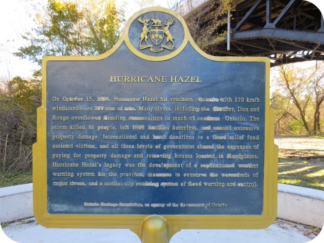
Hurricane Hazel
Photos by Alan L Brown - Posted November, 2013
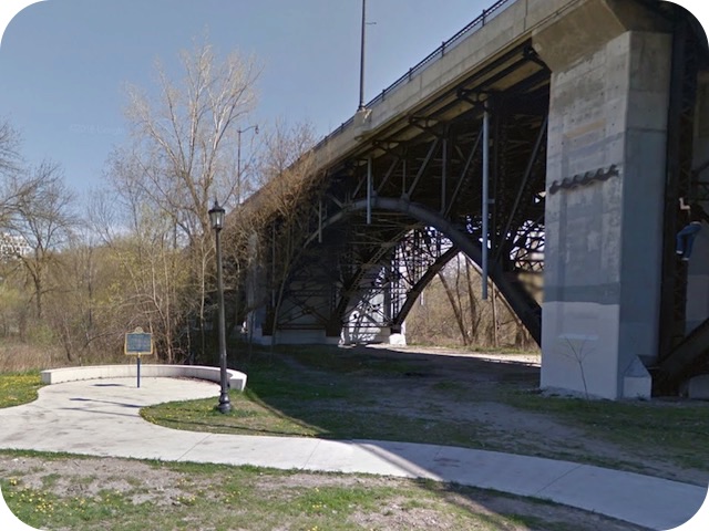
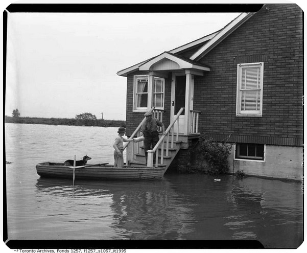
Photo Source - Toronto Archives
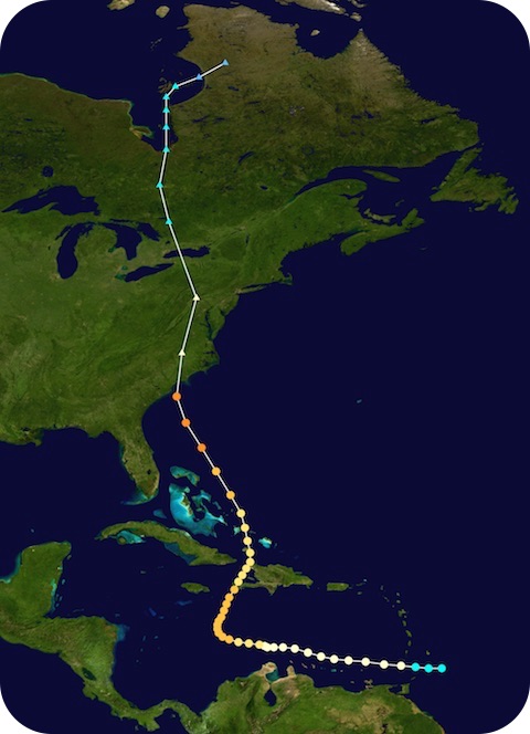
Photo Source - Wikipedia
This Story Circle, the ninth of 13 story circles on the "Discovery Walks - The Shared Path", can be found between the Bloor Street Bridge and the TTC Subway Bridge. The wavy line on the concrete bridge pillar in the second photo marks the level the Humber River reached during the flood. Here's what the Ontario Heritage Trust plaque tells us about the hurricane:
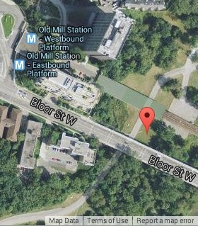
Coordinates: 43.649088 -79.493157 |
 |
On October 15, 1954, Hurricane Hazel hit southern Ontario with 110 km/h winds and over 200 mm of rain. Many rivers, including the Humber, Don and Rouge overflowed flooding communities in much of southern Ontario. The storm killed 81 people, left 1868 families homeless, and caused extensive property damage. International and local donations to a flood relief fund assisted victims, and all three levels of government shared the expenses of paying for property damage and removing houses located in floodplains. Hurricane Hazel's legacy was the development of a sophisticated weather warning system for the province, measures to conserve the watersheds of major rivers, and a continually evolving system of flood warning and control.
Shared Path Story Circles Information and Map
Discovery Walks - The Shared Path
Related webpages
Effects of Hurricane Hazel in Canada
Photos of Hurricane Hazel
Related Toronto plaques
Raymore Bridge
Bailey Bridge Construction
Links to all the other Story Circles
#1 Discover the Humber River's Ancient Past
#2 Toronto Carrying Place
#3 Railways Over the Humber
#4 Roads over the Humber River
#5 Boating on the Humber River
#6-1 The Beginnings of French Toronto
#6-2 The Rousseaux Family and Early Toronto
#6-3 Jean-Baptiste Rousseaux 1758-1812
#7 Humber River Marshes and Oak Savannah
#8 Huron-Wendat Villages on the Humber River
#10 The King's Mill
#11 Teiaiagon and the Aboriginal Occupation of Baby Point
#12 Dundas Street Crossing and Lambton Mills
#13 Mississauga Settlements on the Humber River
Here are the visitors' comments for this page.
(none yet)
Here's where you can sent me a comment for this page.
Note: Your email address will be posted at the end of your comment so others can respond to you unless you request otherwise.
Note: Comments are moderated. Yours will appear on this page within 24 hours (usually much sooner).
Note: As soon as I have posted your comment, a reply to your email will be sent informing you.
To send me your comment, click [email protected].
Thanks
Webmaster
Note: If you wish to send me a personal email, click here.