Discover Toronto's history as told through its plaques
2004 - Now in our 13th Year - 2017
To see what's new on this site, you can visit the Home Page
Looking at this page on a smartphone?
For best viewing, hold your phone in Landscape mode (Horizontal)
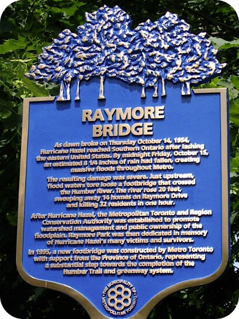
Raymore Bridge
Photos by Alan L Brown - Posted September, 2006
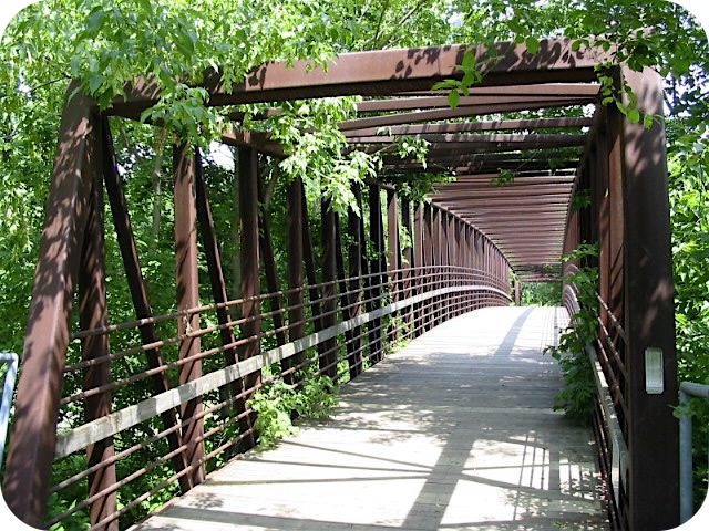
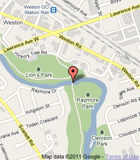
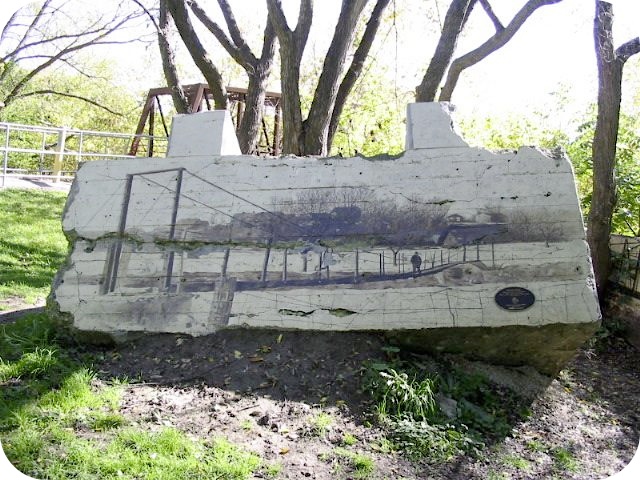
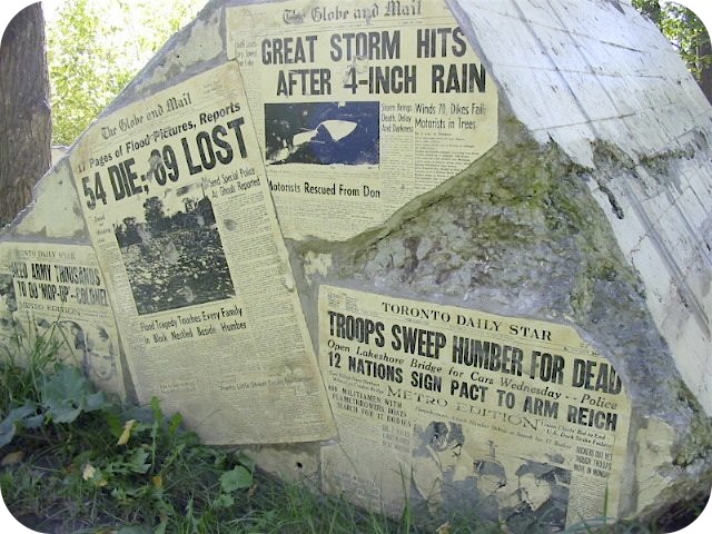
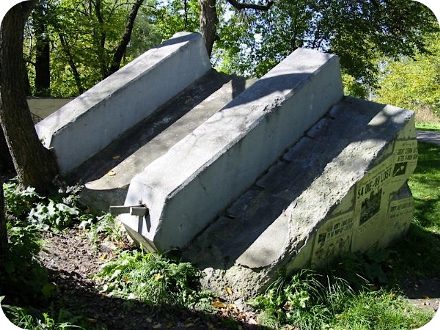
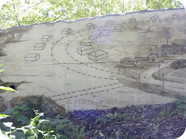
This footbridge over the Humber River near Lawrence Avenue West replaced one destroyed by Hurricane Hazel. Parts of the wrecked footbridge, having been left where they ended up, were turned into memorials to the flood just north of this replacement bridge. Photos of the memorials are further down this page. This Municipality of Metropolitan Toronto plaque commemorating the bridge is located beside a parking lot off Raymore Drive. Here's what the plaque says:
Coordinates: 43.69705 -79.51459 |
 |
As dawn broke on Thursday October 14, 1954, Hurricane Hazel reached Southern Ontario after lashing the eastern United States. By midnight Friday, October 15, an estimated 209 mm of rain had fallen, creating massive floods throughout Metro.
The resulting damage was severe. Just upstream, flood waters tore loose a footbridge that crossed the Humber River. The river rose 6 metres, sweeping away 14 homes on Raymore Drive and killing 32 residents in one hour.
After Hurricane Hazel, the Metropolitan Toronto and Region Conservation Authority was established to promote watershed management and public ownership of the floodplain. Raymore Park was then dedicated in memory of Hurricane Hazel's many victims and survivors.
In 1995, a new footbridge was constructed by Metro Toronto with support from the Province of Ontario, representing a substantial step towards the completion of the Humber Trail and greenway system.
Related website
Metropolitan Toronto and Region Conservation Authority
Related Toronto plaques
Hurricane Hazel
Bailey Bridge Construction
More
Disaster
Transportation
Here are the visitors' comments for this page.
> Posted September 1, 2010
There's a replacement sign there now (bearing the same text). It's a shame that the artwork on the bridge footings monument has faded and is now covered with graffiti. We lived on Gilhaven Avenue (where the Raymore Park parking lot is now) and were lucky not to suffer the same devastation as our neighbours on Raymore. Still, our house was considered part of the flood plain and was demolished to form part of the park.
> Posted September 6, 2008
there is actually a second bridge of this type in the same area @ the base of twin rivers.
Here's where you can sent me a comment for this page.
Note: Your email address will be posted at the end of your comment so others can respond to you unless you request otherwise.
Note: Comments are moderated. Yours will appear on this page within 24 hours (usually much sooner).
Note: As soon as I have posted your comment, a reply to your email will be sent informing you.
To send me your comment, click [email protected].
Thanks
Webmaster
Note: If you wish to send me a personal email, click here.