Discover Toronto's history as told through its plaques
2004 - Now in our 15th Year - 2019
To see what's new on this site, you can visit the Home Page
Looking at this page on a smartphone?
For best viewing, hold your phone in Landscape mode (Horizontal)
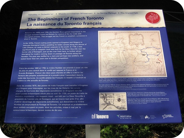
The Beginnings of French Toronto
Photos by Alan L Brown - Posted August, 2011
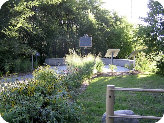
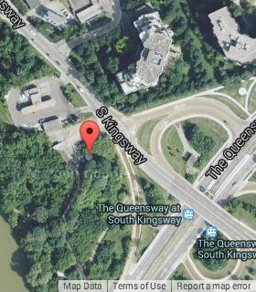
This Story Circle, the sixth of 13 story circles on the "Discovery Walks - The Shared Path", can be found on South Kingsway at the top of a paved boat launching ramp at the south end of a gas station. Here's what the French Toronto plaque has to say:
Coordinates: 43.635906 -79.474819 |
 |
Between the 1660s and 1759, the Humber River gained importance in the struggle between France and Britain for control of the fur trade with Aboriginal peoples. That struggle led the French to establish a presence in what is today Toronto.
In the 1670s, French trading posts opened at Kingston and Niagara to intercept Aboriginal traders paddling fur-laden canoes along the shores of Lake Ontario, en route to British outposts to the south. In 1720, a less significant post or magasin royal was built by the Sieur Douville near the former site of Teiaiagon, just up the river from here, to further attract Aboriginal fur traders coming down le passage de Toronto along the Humber. The post was staffed by a clerk and perhaps two soldiers, and lasted fewer than ten years due to British competition.
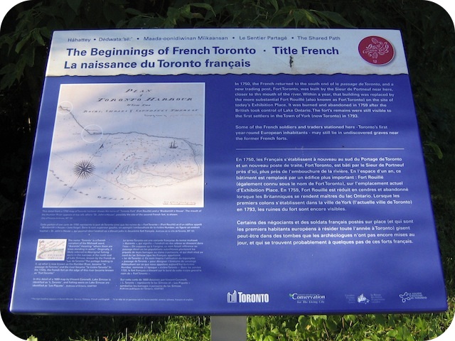
In 1750, the French returned to the south end ofle passage de Toronto, and a new trading post, Fort Toronto, was built by the Sieur de Portneuf near here, closer to the mouth of the river. Within a year, that building was replaced by the more substantial Fort Rouillé (also known as Fort Toronto) on the site of today's Exhibition Place. It was burned and abandoned in 1759 after the British took control of Lake Ontario. The fort's remains were still visible to the first settlers in the Town of York (now Toronto) in 1793.
Some of the French soldiers and traders stationed here - Toronto's first year-round European inhabitants - may still lie in undiscovered graves near the former French forts.
Shared Path Story Circles Information and Map
Discovery Walks - The Shared Path
Related webpages
The Humber River
North American fur trade
Sieur de Portneuf
Teiaiagon
Exhibition Place
Town of York
Related Toronto plaques
Fort Rouillé
Carrying Place portage
More
Pioneers
Links to all the other Story Circles
#1 Discover the Humber River's Ancient Past
#2 Toronto Carrying Place
#3 Railways Over the Humber
#4 Roads over the Humber River
#5 Boating on the Humber River
#6-2 The Rousseaux Family and Early Toronto
#6-3 Jean-Baptiste Rousseaux 1758-1812
#7 Humber River Marshes and Oak Savannah
#8 Huron-Wendat Villages on the Humber River
#9 Hurricane Hazel
#10 The King's Mill
#11 Teiaiagon and the Aboriginal Occupation of Baby Point
#12 Dundas Street Crossing and Lambton Mills
#13 Mississauga Settlements on the Humber River
Here are the visitors' comments for this page.
(none yet)
Here's where you can send me a comment for this page.
Note: Your email address will be posted at the end of your comment so others can respond to you unless you request otherwise.
Note: Comments are moderated. Yours will appear on this page within 24 hours (usually much sooner).
Note: As soon as I have posted your comment, a reply to your email will be sent informing you.
To send me your comment, click [email protected].
Thanks
Webmaster
Note: If you wish to send me a personal email, click here.