Discover Toronto's history as told through its plaques
2004 - Now in our 15th Year - 2019
To see what's new on this site, you can visit the Home Page
Looking at this page on a smartphone?
For best viewing, hold your phone in Landscape mode (Horizontal)
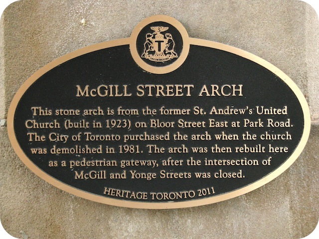
McGill Street Arch
Photos and transcription by contributor Wayne Adam - Posted February, 2012

Attached to the inside of the south pillar of this arch on the east side of Yonge Street south of Carlton Street is this 2011 Heritage Toronto plaque. This is what it says:
Coordinates: 43.659910 -79.382417 |
 |
This stone arch is from the former St. Andrew's United Church (built in 1923) on Bloor Street East at Park Road. The City of Toronto purchased the arch when the church was demolished in 1981. The arch was then rebuilt here as a pedestrian gateway, after the intersection of McGill and Yonge Streets was closed.
Related webpage
arch
More
Transportation
Here are the visitors' comments for this page.
(none yet)
Here's where you can send me a comment for this page.
Note: Your email address will be posted at the end of your comment so others can respond to you unless you request otherwise.
Note: Comments are moderated. Yours will appear on this page within 24 hours (usually much sooner).
Note: As soon as I have posted your comment, a reply to your email will be sent informing you.
To send me your comment, click [email protected].
Thanks
Webmaster
Note: If you wish to send me a personal email, click here.