Discover Toronto's history as told through its plaques
2004 - Now in our 15th Year - 2019
To see what's new on this site, you can visit the Home Page
Looking at this page on a smartphone?
For best viewing, hold your phone in Landscape mode (Horizontal)
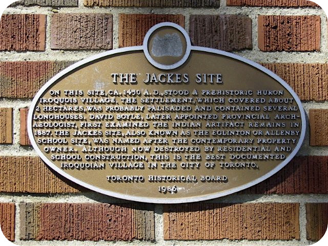
The Jackes Site
Photos by Alan L Brown - Posted September, 2006
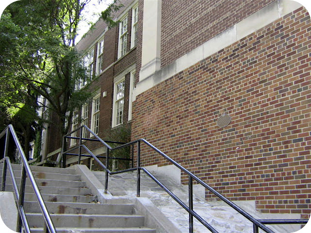
Attached to this wall at Allenby School at 391 St. Clements Avenue is an 1986 Toronto Historical Board plaque which says:
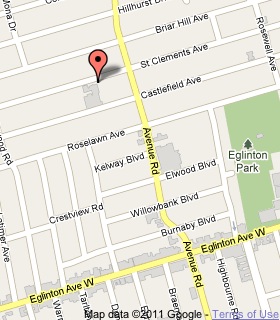
Coordinates: 43.709874 -79.412500 |
 |
On this site, ca. 1450 A.D., stood a prehistoric Iroquois village. The settlement, which covered about 2 ha, was probably palisaded and included several longhouses. David Boyle, later appointed Provincial Archaeologist, first examined the Indian artifact remains in 1887. The Jackes site, also known as the Eglinton or Allenby School Site, was named after the contemporary property owner. Although now destroyed by residential and school construction, this is the best documented Iroquoian village in the City of Toronto.
Related webpages
The Jackes Site
Iroquois
longhouses
David Boyle
Related Toronto plaques
The Alexandra Site
Indian Village Site
Parsons Site
Withrow Archaeological Site
Related Ontario plaques
Crawford Lake Indian Village Site
Cummins Site
The Lawson Site
The Nodwell Indian Village Site
Roebuck Indian Village Site
Upper Gap Archaeological Site
More
First Nations
Here are the visitors' comments for this page.
(none yet)
Here's where you can send me a comment for this page.
Note: Your email address will be posted at the end of your comment so others can respond to you unless you request otherwise.
Note: Comments are moderated. Yours will appear on this page within 24 hours (usually much sooner).
Note: As soon as I have posted your comment, a reply to your email will be sent informing you.
To send me your comment, click [email protected].
Thanks
Webmaster
Note: If you wish to send me a personal email, click here.