Discover Toronto's history as told through its plaques
2004 - Now in our 14th Year - 2018
To see what's new on this site, you can visit the Home Page
Looking at this page on a smartphone?
For best viewing, hold your phone in Landscape mode (Horizontal)
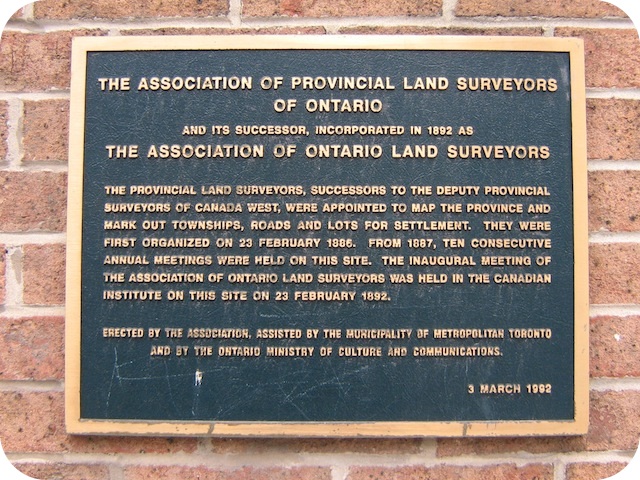
The Association of Provincial Land Surveyors of Ontario
Photos by Alan L Brown - Posted February, 2012

On the wall of this building on the northwest corner of Richmond Street East and Berti Street is this 1992 plaque. Here is what it says:
Coordinates: 43.652336 -79.376548 |
 |
The provincial land surveyors, successors to the deputy provincial surveyors of Canada West, were appointed to map the province and mark out townships, roads and lots for settlement. They were first organized on 23 February 1886. From 1887, ten consecutive annual meetings were held on this site. The inaugural meeting of the Association of Ontario Land Surveyors was held in the Canadian Institute on this site on 23 February 1892.
Related webpages
Association of Ontario Land Surveyors
surveying
Related Toronto plaque
William Thomas 1799-1860
More
Associations
Here are the visitors' comments for this page.
(none yet)
Here's where you can sent me a comment for this page.
Note: Your email address will be posted at the end of your comment so others can respond to you unless you request otherwise.
Note: Comments are moderated. Yours will appear on this page within 24 hours (usually much sooner).
Note: As soon as I have posted your comment, a reply to your email will be sent informing you.
To send me your comment, click [email protected].
Thanks
Webmaster
Note: If you wish to send me a personal email, click here.